Take action
$60
$80
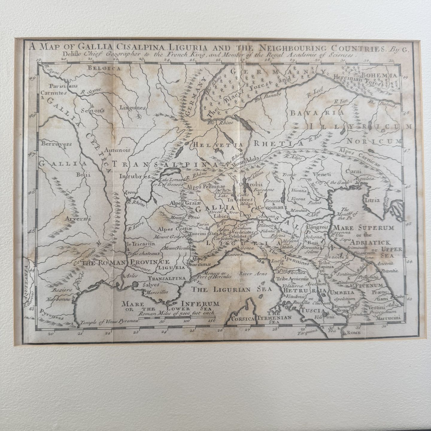
detailed historical map of the European region during the Roman era, entitled "A Map of Gallia Cisalpina Liguria and the Neighbouring Countries
Posted in Phoenix, AZ
Listed in categories:
Chat securely on the app

Additional images
Description
It was created by Guillaume Delisle (or Delille), who was the chief geographer to the French king and a member of the Royal Academy of Sciences. The map depicts areas including Cisalpine Gaul, Liguria, Germania, Helvetia (modern-day Switzerland), and parts of Bavaria and Illyricum. It details geographical features such as the Rhine River, the Danube River, the Adriatic Sea ("Mare Superum"), and the Tyrrhenian Sea ("Mare Inferum"). It shows ancient tribes such as the Insubres, Cenomanians, and Veneti, as well as Roman cities like Rome. It provides a scale of measurement in Roman miles.
All content is available to screen readers from the outset. The See more button is for visual users only to expose content incrementally that is already available to you
Details
Condition
Used (normal wear)
All content is available to screen readers from the outset. The See more button is for visual users only to expose content incrementally that is already available to you
Item location map
Map is approximate to keep seller’s location private.