Los Angeles 1980 Black Population Census Map Poster
$45
Last updated 12 months ago in City Of Industry, CA
Condition: Used (normal wear)
Listed in categories: Collectibles & Art - Antiques - Maps, Atlases, & Globes
Chat securely on the app

Sold by
Additional images
Details
Century
20th century
Type
North America map
Description
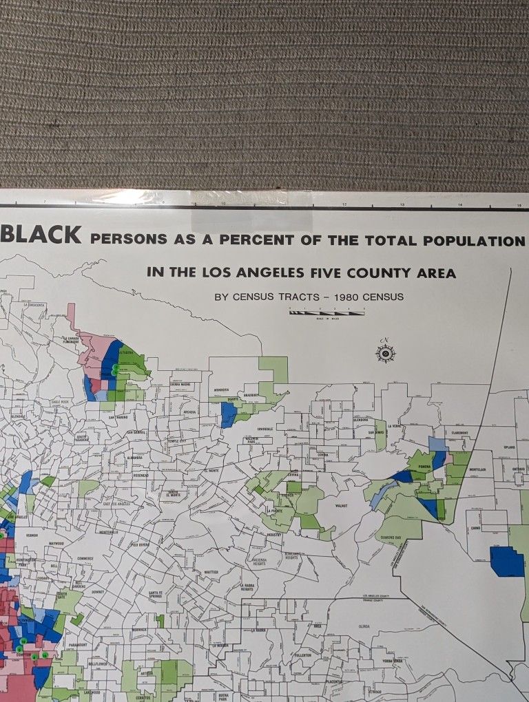
huge historical map from 1980 showing the percentage of black population in each neighborhood of LA and the surrounding 5 county area. It looks similar to a red-lining map, and was made by a marketing company doing research on where supermarkets existed in areas with high black populations so that new supermarkets could be planned for the year 1984. there is a transparent overlay with some stickers which can be folded back behind the map if you choose. Really interesting when you look into how areas have changed, gentrification, and where food deserts have historically existed, and still do. It measures 42.5" x 30" or so. I don't have anymore historical LA demographic maps or books left, this is my last one I found in storage. history projects map African American black demographics census information statistics economics textbook study racial studies red line red lining corruption systemic
Take action
Item location map
Map is approximate to keep seller’s location private.
Related searches
- Antique dresser
- Antique furniture
- Antique desk
- Antique table
- Antique mirror
- Antique clocks
- Antique chairs
- Antique cabinets
- Antique bottles
- Antique armoire
- Antique lamps
- Antique dolls
- Antique china
- Antique glass
- Vintage lamp
- Vintage pyrex
- Candelabra